42 For Loowit’s 42nd vol. 2: March Awakening
There’s this old saying about March: “In like a lamb, out like a lion.” This turned out to be very true in Loowit’s case as the 1980s began.
After over a century of peaceful slumber, Loowit (Mount St. Helens) began to wake. Seismic activity is nothing new around volcanoes, but this swarm was intense enough to shake the snow from her summit.

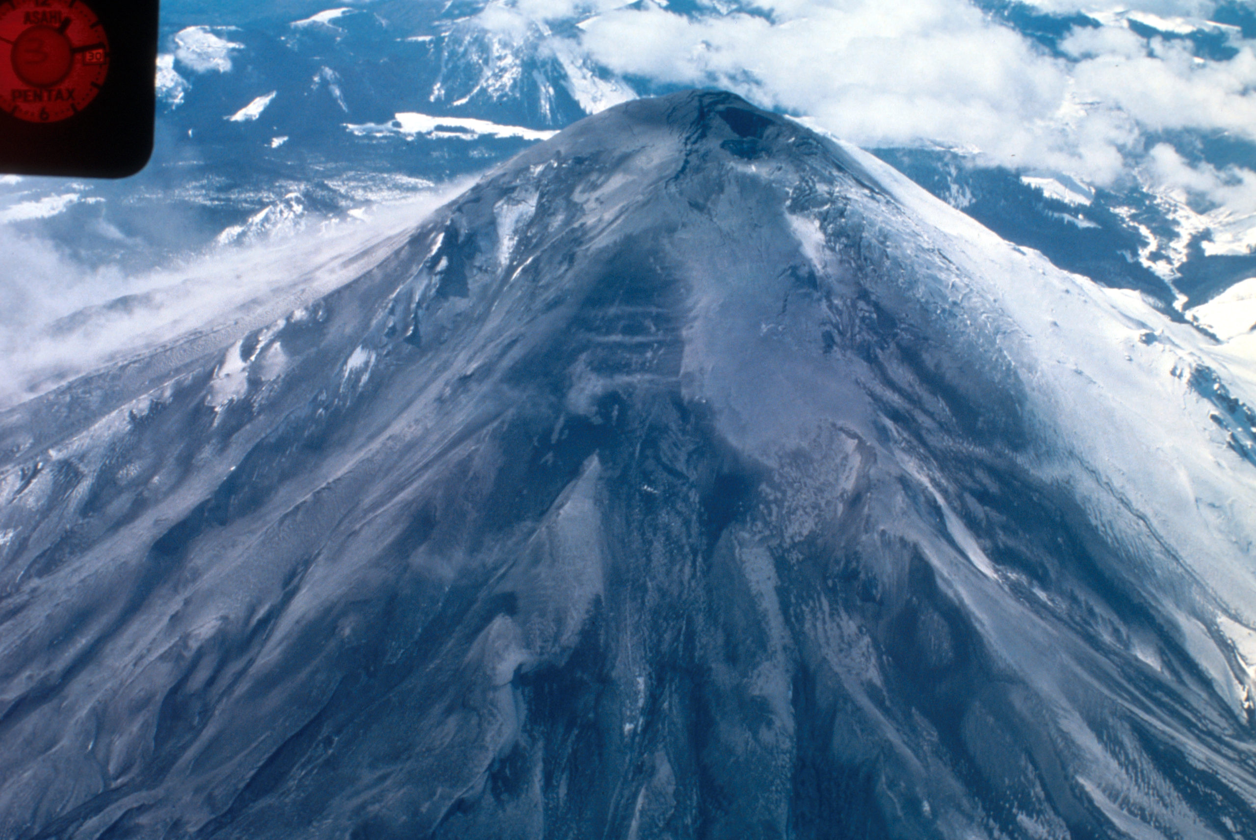
North side of Mount St. Helens, Washington, as of 24 March 1980. Numerous snow avalanche fracture scarps may be related to continued earthquake shaking. No signs of volcanic activity are evident. Caption and image credit: USGS
She still looked lovely and serene, but as March waned, signs became increasingly clear that magma was on the move in a serious way.

Loowit’s summit on 3/24/1980, showing a historic thermal area. You can see cracks beginning to form in the snowpack. Credit: USFS
And then, almost before people could grasp the fact that the first volcanic eruption in the Lower 48 since Kohm Yah-mah-nee (Lassen Peak), the first in many Americans’ lifetimes, was about to happen, she cleared her throat and started rehearsing for her big event.

The first eruption on 3/27/1980. You can see it’s mostly steam, with just a bit of ash created when the steam blast pulverized old summit lava. Credit: USFS
It was just a bit of a steam blast. No juvenile magma emerged. But magma was close enough to the surface to heat water to steam, and Loowit was sporting a brand-new crater.

View from north of Mount St. Helens crater on day of first blast, March 27, 1980. Caption and image credit: USGS
By March 29th, ash was dusted over the snow-covered countryside and causing some really intriguing textures.

Snow having surface layer of ash with curd texture. Sample collected east of Mount St. Helens in Smith Creek. Coin for scale. Skamania County, Washington. March 29, 1980. Caption and image credit: USGS
Loowit ended the month with a bang.

Loowit in eruption on 3/30/1980. Credit: USFS
But it was impossible to tell if she’d put on just a brief show before quickly returning to sleep, or if she was working her way up to a major production.
There was that matter of the bulge…
Featured image: Mount St. Helens summit graben and bulge from northeast. Skamania County, Washington. March 30, 1980. Caption and image credit: USGS.

Rosetta Stones and Dana Hunter’s Unconformity wouldn’t be possible without you! If you like my content, there are many ways to show your support.


![]()
This website is a member of the Amazon Affiliates program. I get a small commission when you use my affiliate link to make a purchase.

Thank you so much for your support!