Tag: USGS
When Whirlwinds Meet Hot Lava: Lava Devils!
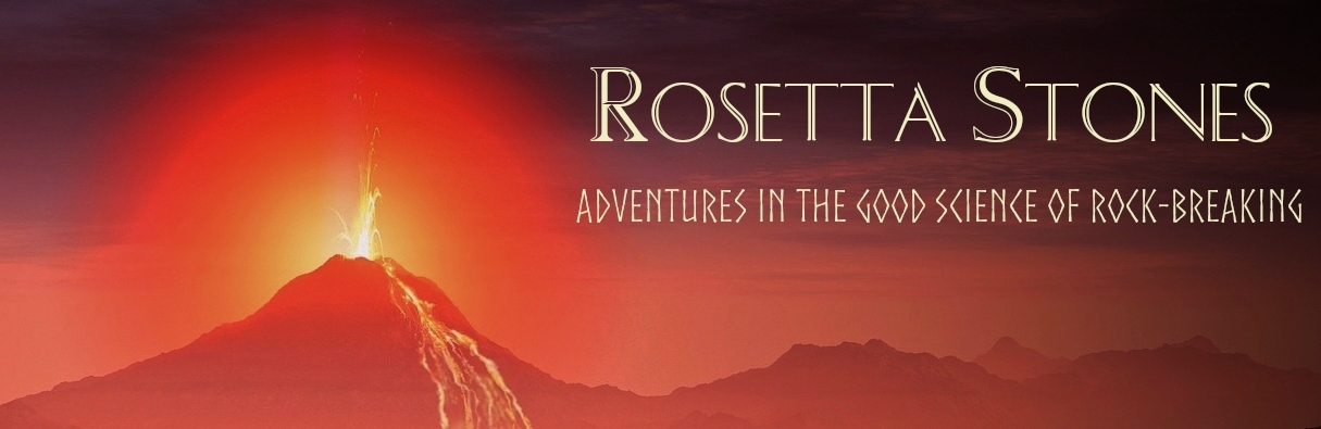
There are so many things to see while watching a livestream of a volcanic eruption. Lava fountains, spatter cones being built up and falling down, turbulence in lava flows… and lava devils?!
Yes, indeed! Keep your focus on the left in the video below, and you’ll see molten lava sucked up and flung about by a vigorous little whirlwind during Kilauea’s latest summit eruption: (more…)
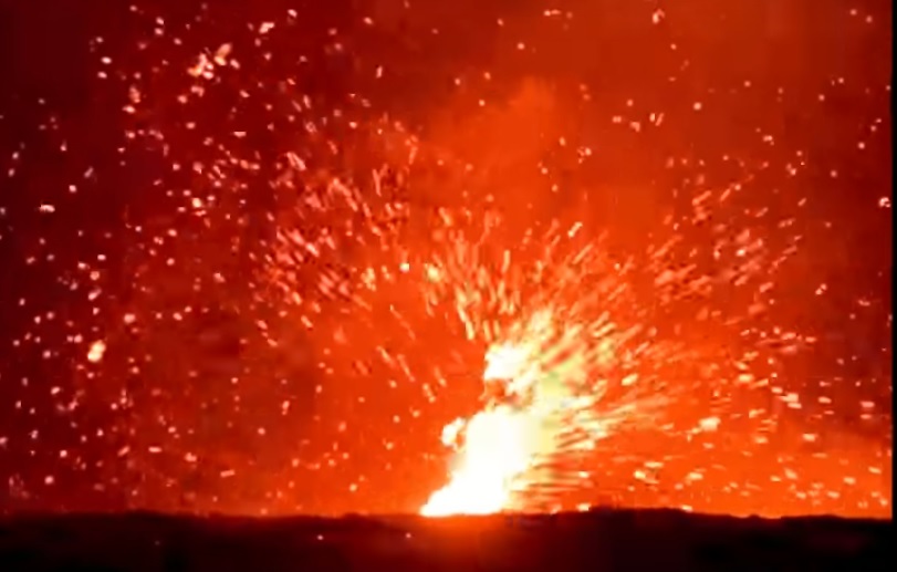
The 2023 Turkey Earthquakes: “It Felt Like It Would Never Be Over”
Turkey and Syria are reeling after being struck by two enormous earthquakes in quick succession. Both earthquakes occurred along the East Anatolian Fault Zone; between them and their aftershocks, the damage is catastrophic, and the death toll is already in the thousands and rapidly climbing.
The first earthquake, striking near Gaziantep at 4:17 am local time, was measured by the USGS as a M7.8. At first, it wasn’t clear whether this earthquake struck within the East Anatolian Fault Zone (EAFZ) or the Dead Sea Transform fault zone. As of this writing, it appears it was located within the EAFZ.
The second earthquake struck near Ekinözü at 1:24 pm local time, and measured as a M7.5. Though it was 95 kilometers northeast of the initial quake and on a separate fault, it qualifies as an aftershock instead of a stand-alone earthquake. More on that later in this post.
We won’t have a clear picture of precisely which faults were involved, the details of the earthquakes, and the implications for the region going forward for months, possibly longer. Once we have some solid science, I’ll write up a properly detailed post for you. For today, I’ll go over some of the best available science, share some sobering videos, and provide ways you can help people in the affected region. (more…)
Video: Kilauea Eruption’s Spectacular Return
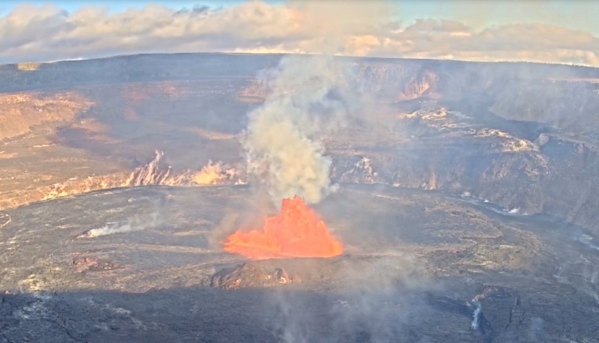
After giving the world a lovely early midwinter gift with the first eruption of Mauna Loa in 38 years, Madam Pele took the holidays off. Kilauea’s summit eruption paused on December 9th, possibly due to the relief of stress as its neighbor’s reservoir emptied.* Mauna Loa’s display ended on the 13th, and both volcanoes slumbered peacefully through the new year.
Pele returned to Kilauea with a spectacular lava show on January 5th. And I’ve got the videos all nicely arranged for you.
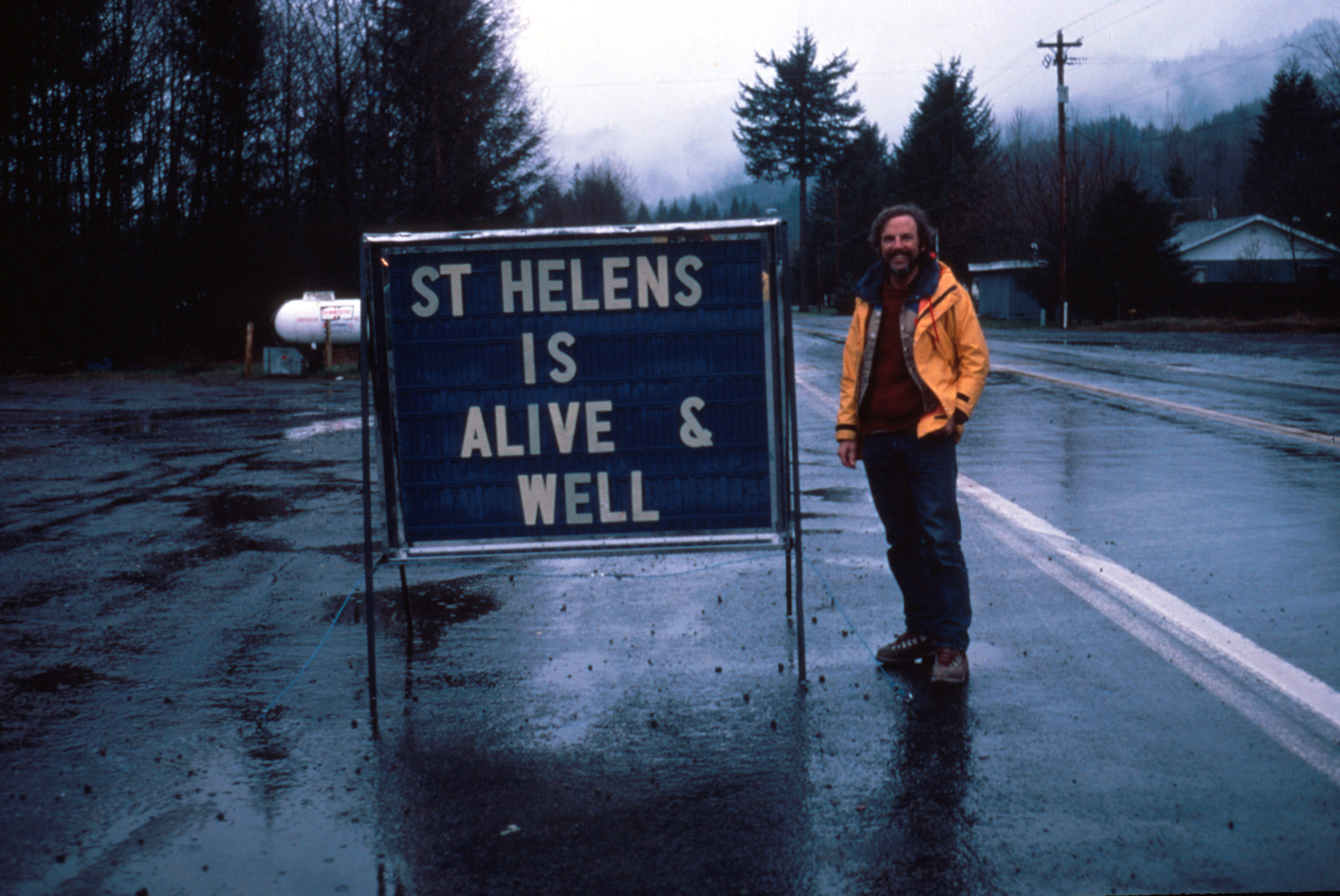
42 for Loowit’s 42nd vol. 7: Reprise
There was life in the old girl yet.
To be fair, though, Loowit (Mount St. Helens) isn’t very old as far as volcanoes go. So when she rumbled awake in late September of 2004, volcanologists weren’t terribly surprised. She’d slumbered for less than 20 years after her 80s eruptive sequence, but it wasn’t shocking to see magma on the move again.
Her prompt eruption on October 1st signalled a new phase of dome building. And this time, we had better cameras, better monitoring equipment, and the plans in place to do some serious monitoring.

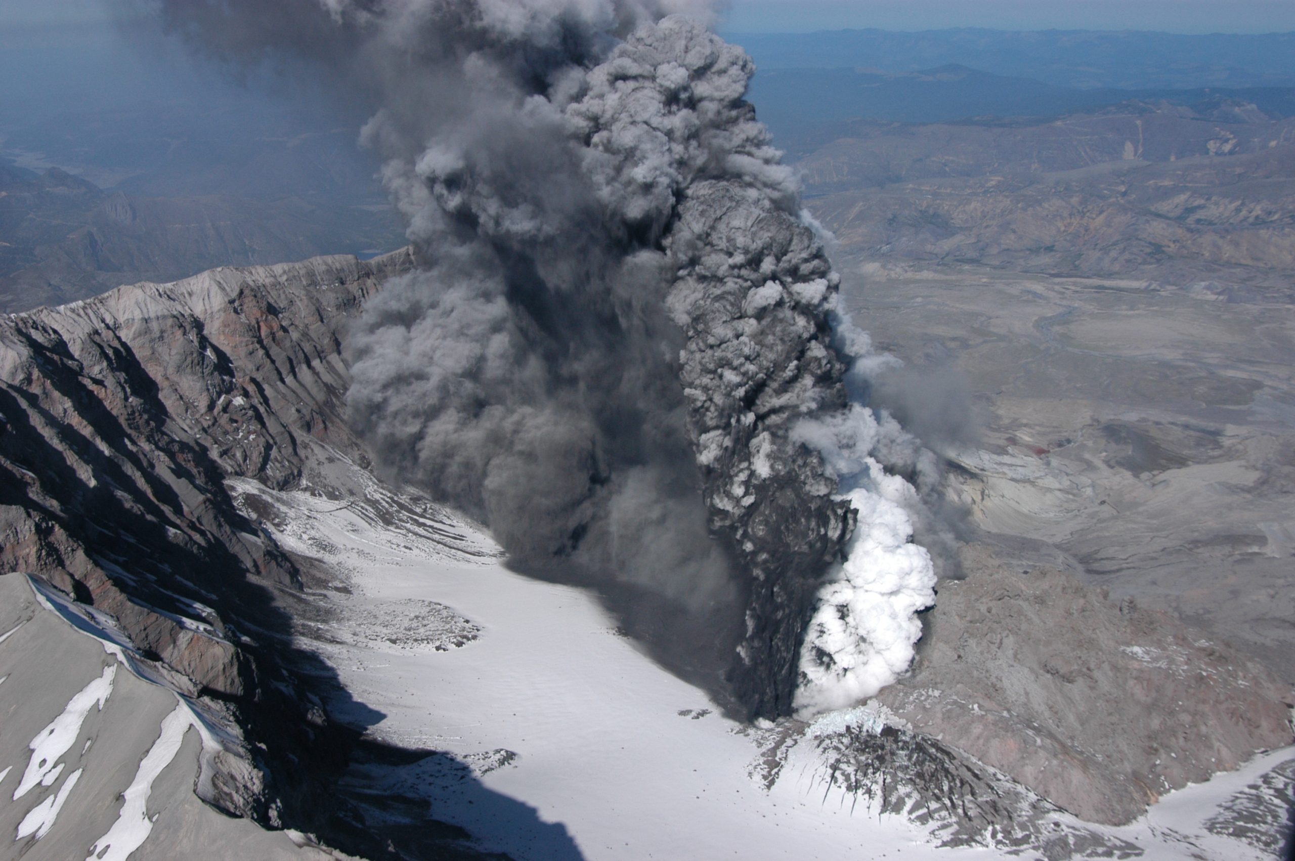
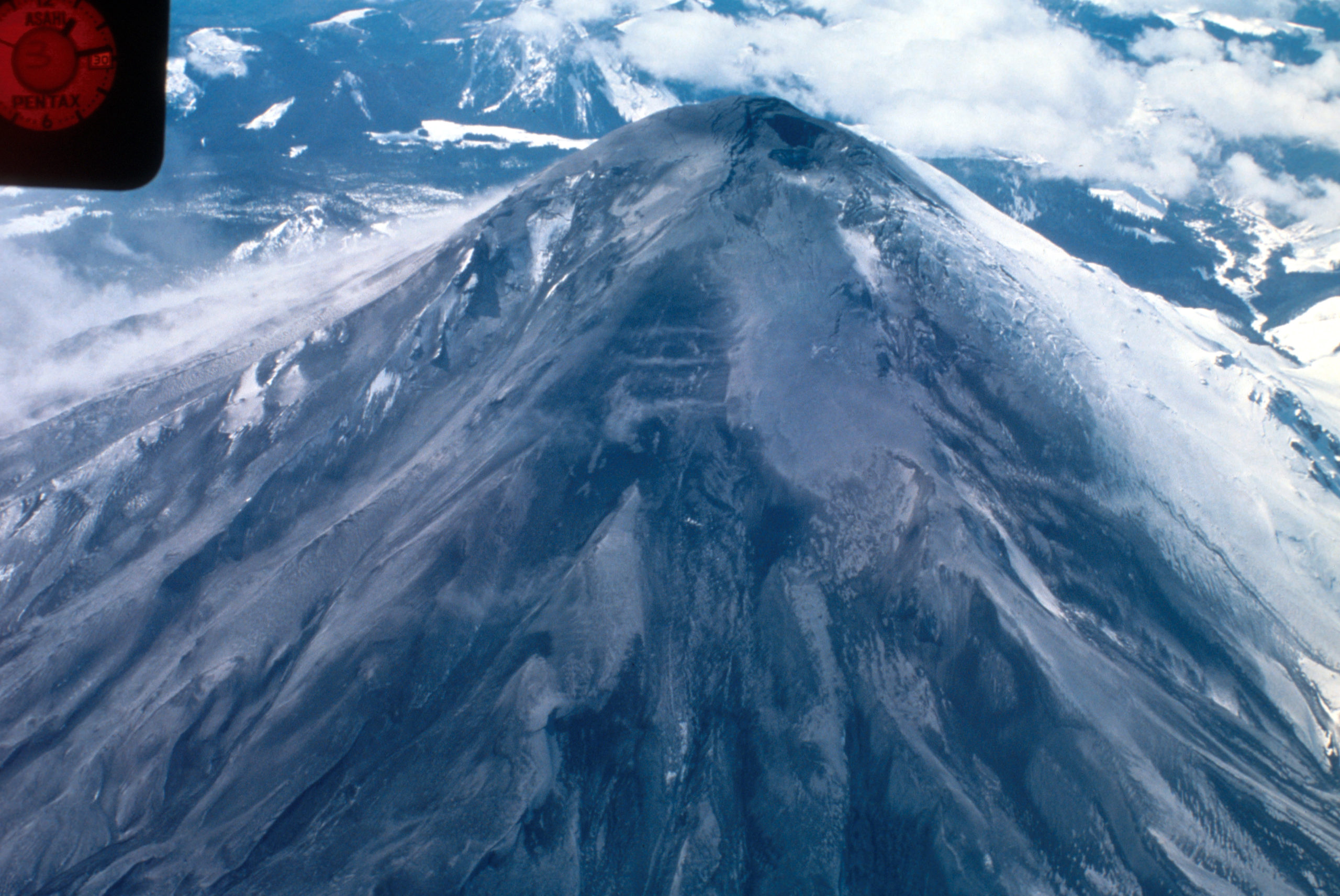
Dome within Mount St. Helens’ crater is hot and glowing as it grows, viewed from Johnston Ridge Observatory (JRO), with base of small steam and ash plume. 11/4/2004. Caption and image credit: USGS
She put on a beautiful show. (more…)
42 for Loowit’s 42nd vol. 6: Beauty in Destruction
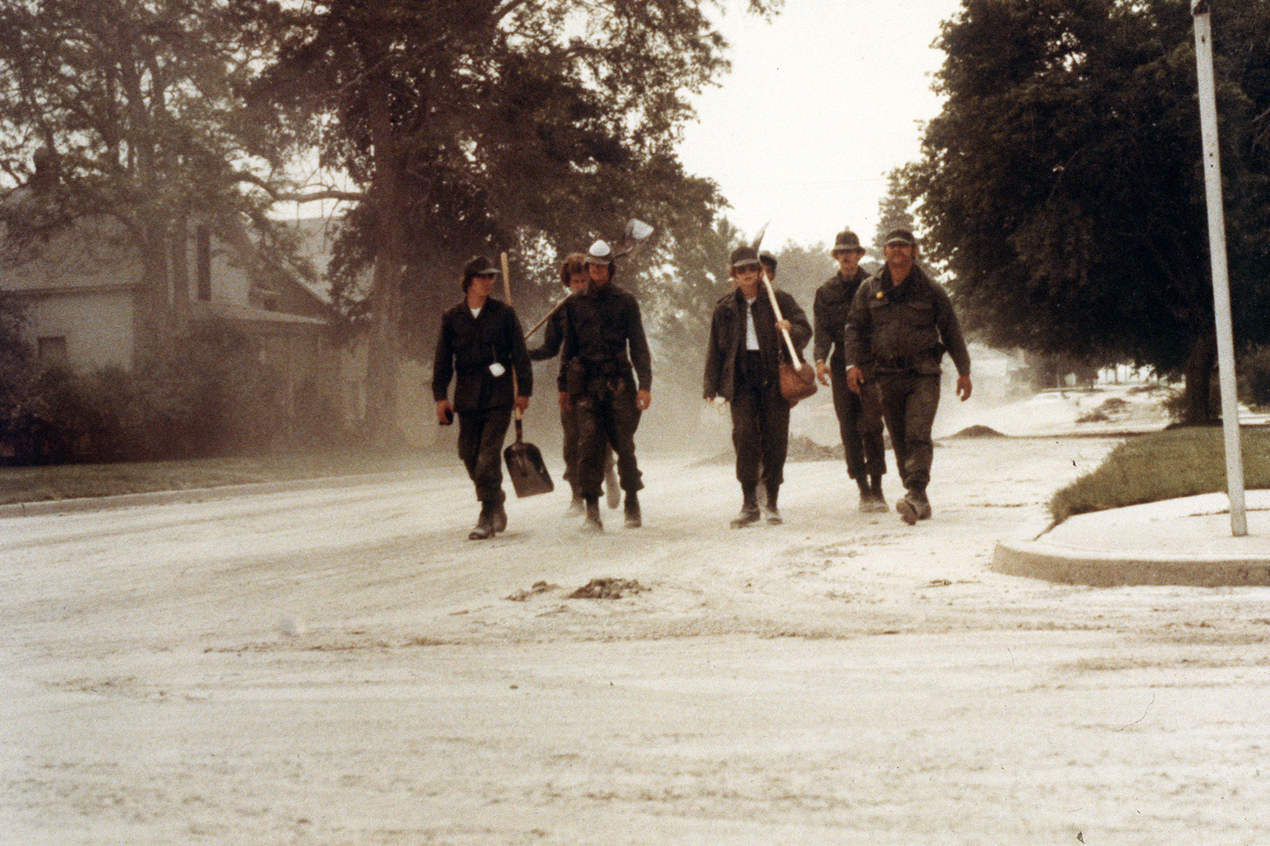
Volcanoes leave one heck of a mess to clean up when they explode near civilization. It’s not pretty, although as you can see above, it sometimes looks pretty metal.
While Washington State called out the National Guard and folks figured out how to cope with the copious ash, volcanologists picked through the ruins of a once-verdant forest, measuring various volcanic deposits and learning all they could from them. At first, it was shocking. But once you started adjusting to the change, you could start seeing the beauty in the devastation.
Look at the channel carved through the debris avalanche here: you can see gorgeous reds in the gray where hydrothermally altered rock from the former summit mixed with the more prosaic grays of younger material. The iron-stained creek flowing through added more color to the moonscape. It was alien and strangely pretty. (more…)
42 for Loowit’s 42nd vol. 5: Cataclysm
It’s a beautiful, quiet morning with spectacular weather, and then suddenly it isn’t. An earthquake strikes, the bulge gives way, and the volcano blows up and out.

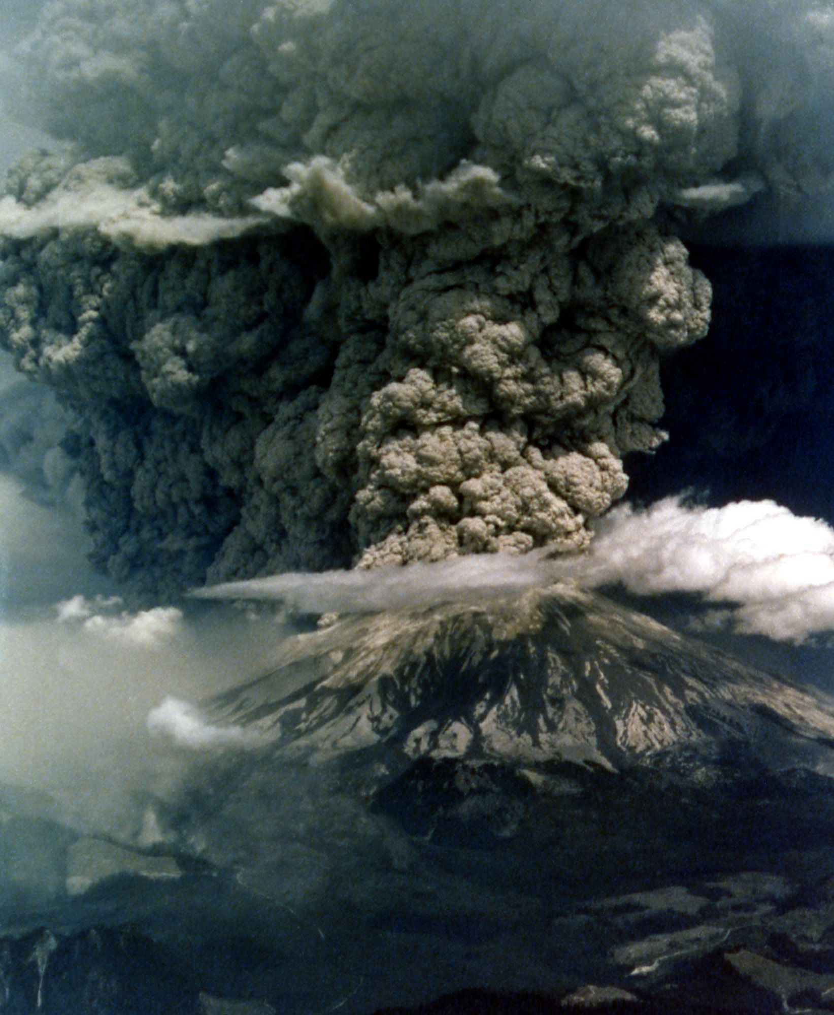
Mount St. Helens in eruption. Aerial view of base of eruptive column, crater rim at right. Shows “cauliflower” effect in column. 1235 hrs PDT. Skamania County, Washington. May 18, 1980. Caption and image credit: USGS
This actually isn’t a particularly large eruption. Between the lateral blast, Plinian ash column, and the pyroclastic flows, it totals only about 1.4 cubic kilometers of material. Barely a VEI of 5. But if you’re in it, it seems large enough to have swallowed the world. It is, indeed, cataclysmic.
42 for Loowit’s 42nd vol. 4: Menacing May
May had begun with an ominous quiet.
Ominous? Surely a restless volcano quieting down is a good thing!
Yeah, not when you’ve got one flank of the mountain growing a bulge like a demonic pregnancy and displaying worrying new thermal anomalies. Add in earthquakes and dramatic swelling, and you’re sure the volcano is ready to pop.

Geodimeter station at Toutle Canyon near Mount St. Helens. Skamania County, Washington. May 2, 1980. Caption and image credit: USGS
[Monty Python voice] Look at the bulge! (more…)
42 for Loowit’s 42nd vol. 3: Ominous April
For the people who lived and worked on the flanks of Loowit (Mount St. Helens), her awakening was both curse and blessing. Living with a restless stratovolcano isn’t safe nor comfortable. But the tourism it draws is great for the local economy. Locals leaned in, creating funny hats and shirts, renaming menu items, and finding other creative ways to capitalize on her activity.
For the scientists who flocked to her, it was the chance of a lifetime.

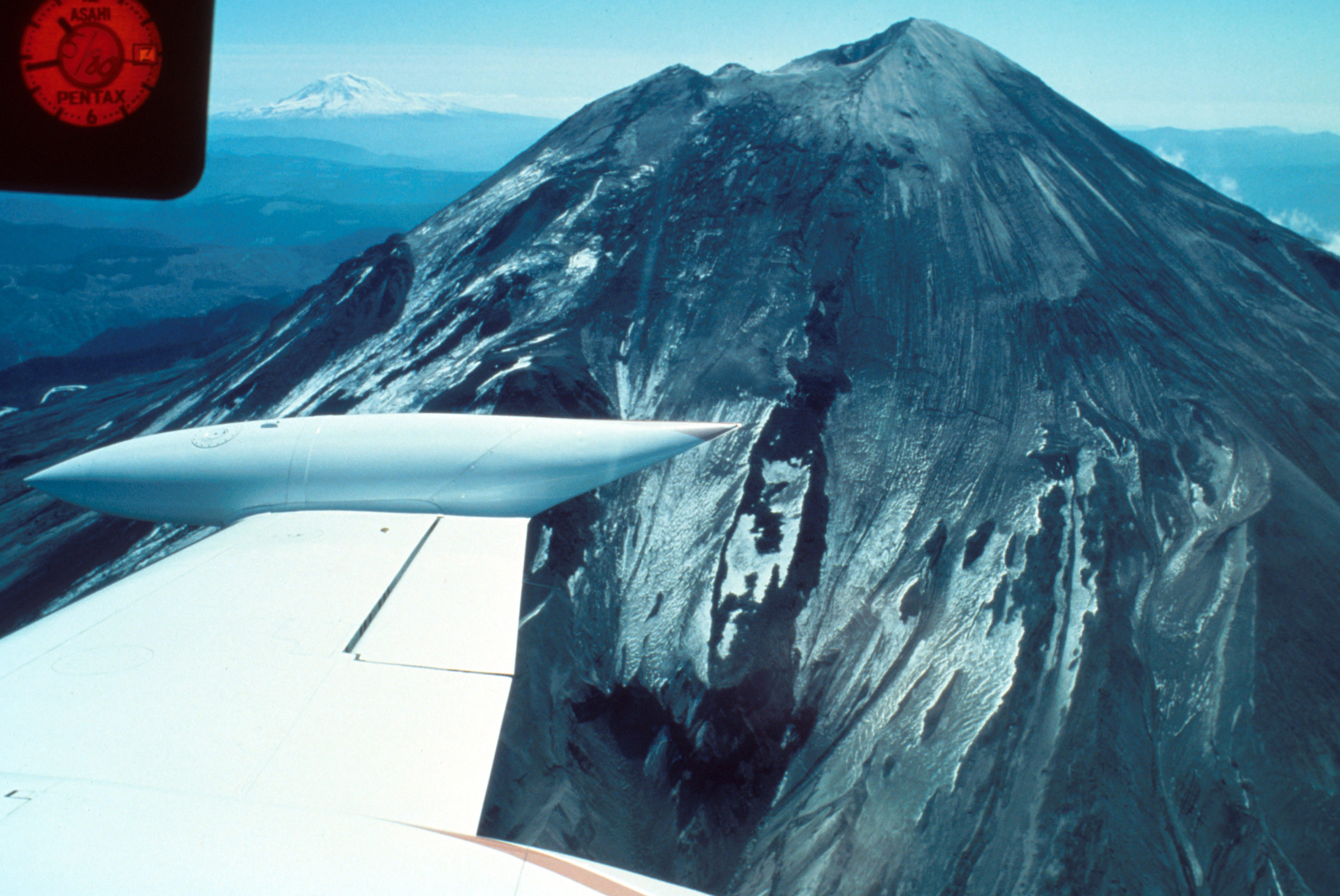
Aerial view of Mount St. Helens and drifting plume, from northwest. Photo taken from U.S. Forest Service observer plane at 12:32 p.m. Skamania County, Washington. April 4, 1980. Caption and image credit: USGS
Volcanologists flocked to her slopes, installing equipment, taking measurements and photos, and flying over the summit as steam and ash spurted into the sky. They’d seldom had a chance to study an actively erupting composite cone so conveniently close to highways and large cities. Loowit was wonderfully accessible, and easy to observe, even in the Pacific Northwest’s capricious early spring weather. (more…)
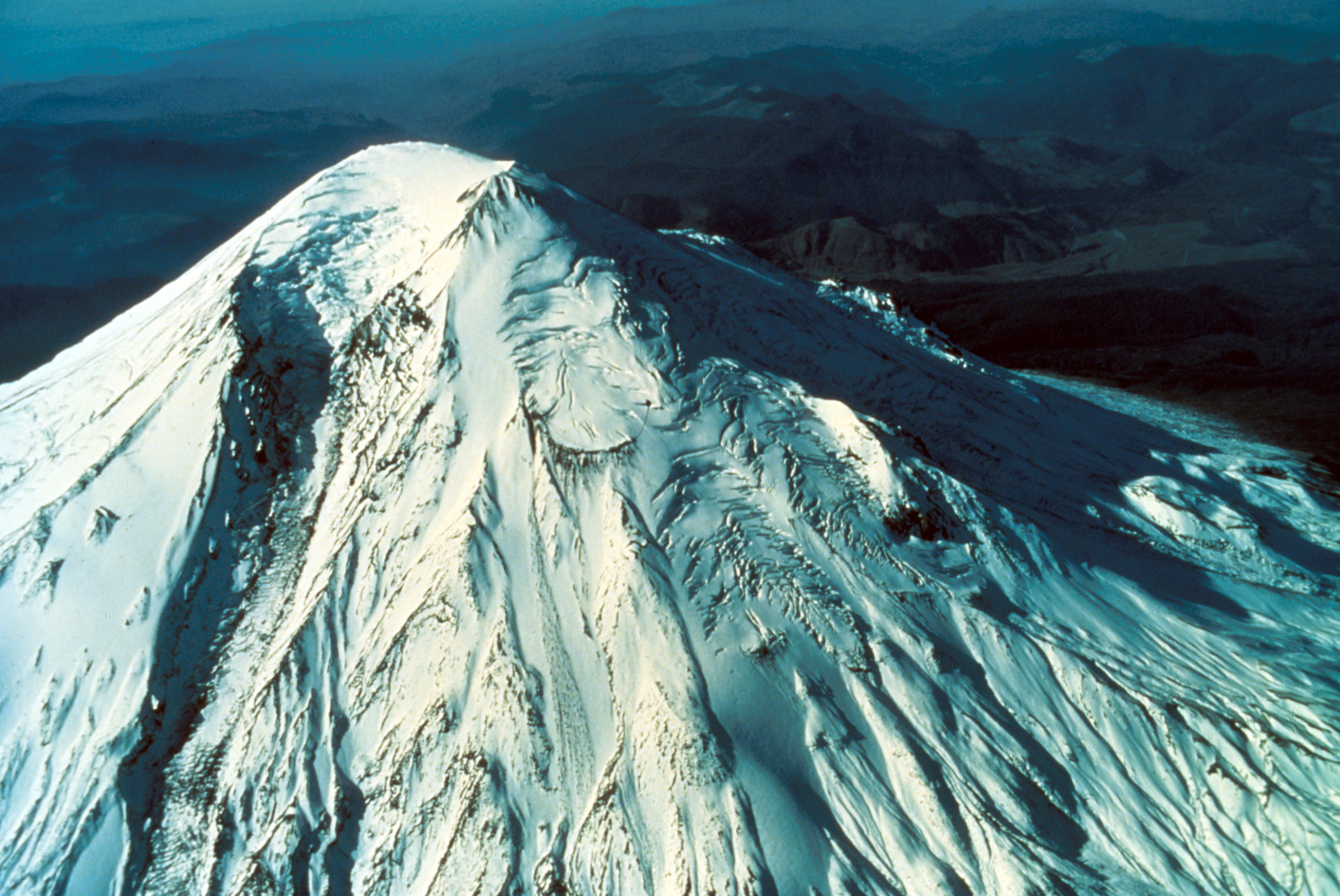
42 For Loowit’s 42nd vol. 2: March Awakening
There’s this old saying about March: “In like a lamb, out like a lion.” This turned out to be very true in Loowit’s case as the 1980s began.
After over a century of peaceful slumber, Loowit (Mount St. Helens) began to wake. Seismic activity is nothing new around volcanoes, but this swarm was intense enough to shake the snow from her summit.

North side of Mount St. Helens, Washington, as of 24 March 1980. Numerous snow avalanche fracture scarps may be related to continued earthquake shaking. No signs of volcanic activity are evident. Caption and image credit: USGS
She still looked lovely and serene, but as March waned, signs became increasingly clear that magma was on the move in a serious way. (more…)
42 for Loowit’s 42nd vol. 1: Pre-1980 Majesty
What’s the answer to life, the Universe, and how many years it’s been since Loowit (Mount St. Helens) erupted? Why, 42, of course! We’ve plundered the archives of the United States Geological Survey and the US Forest Service for 42 of the best historical photos, plus bonus featured images.
Grab your towels and join me on an epic journey back to the 20th Century, in those years when plate tectonics was still in its infancy, volcanology was still young, and Loowit had yet to stir.