Tag: earthquake
Iceland Eruption Nearly Inevitable; Grindavík Could Go Under Lava
Up til now, volcanic eruptions on Iceland’s Reykjanes Peninsula were benevolent tourist attractions. They put on pretty shows and confined themselves to remote, unpopulated areas, clustered around Fagradalsfjall. No important infrastructure was harmed. People got to hike up and safely experience the birth of a new volcano. It was as good as volcanic eruptions get.

Previous Fagradalsfall Eruption Sites. Credit: Icelandic Meteorological Office
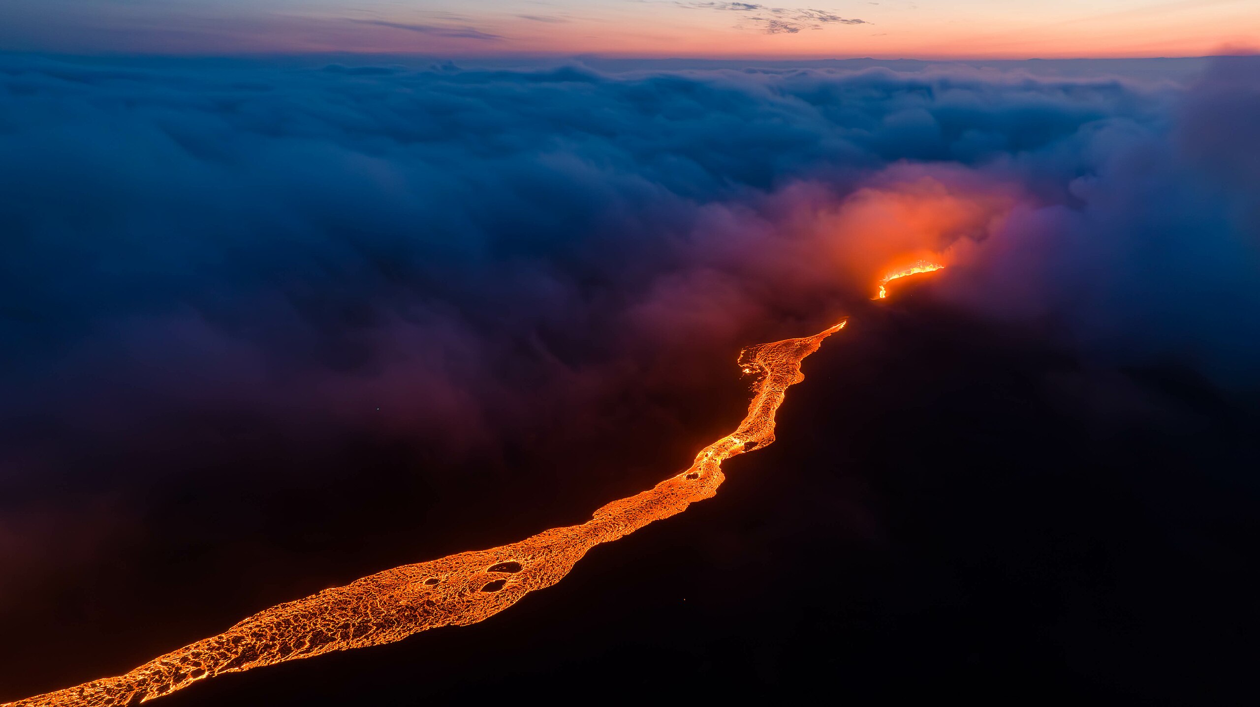
Magma started intruding under Fagradalsfjall in September, just a couple of months after the end of its third eruption. Until late October, it didn’t look like things would get too exciting. But a seismic swarm started near the Blue Lagoon area just north of Grindavík late on the 24th and ramped up dramatically overnight. Over one thousand earthquakes, the largest a M4.5, were recorded overnight, most at a depth of around 5 kilometers. By the next day, the numbers had risen to 4,000, some as shallow as 2 kilometers. And the ground was beginning to deform.
On the 27th, horizontal ground displacement was already up to 2 centimeters, and a M4.0 was recorded just 2 kilometers north of Grindavík. Yikes.
But magma hadn’t started moving on up yet.
The 2023 Turkey Earthquakes: “It Felt Like It Would Never Be Over”
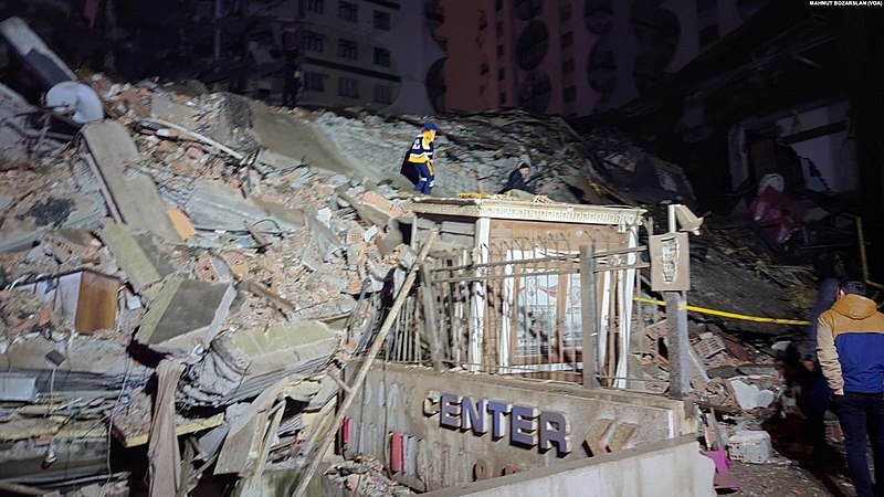
Turkey and Syria are reeling after being struck by two enormous earthquakes in quick succession. Both earthquakes occurred along the East Anatolian Fault Zone; between them and their aftershocks, the damage is catastrophic, and the death toll is already in the thousands and rapidly climbing.
The first earthquake, striking near Gaziantep at 4:17 am local time, was measured by the USGS as a M7.8. At first, it wasn’t clear whether this earthquake struck within the East Anatolian Fault Zone (EAFZ) or the Dead Sea Transform fault zone. As of this writing, it appears it was located within the EAFZ.
The second earthquake struck near Ekinözü at 1:24 pm local time, and measured as a M7.5. Though it was 95 kilometers northeast of the initial quake and on a separate fault, it qualifies as an aftershock instead of a stand-alone earthquake. More on that later in this post.
We won’t have a clear picture of precisely which faults were involved, the details of the earthquakes, and the implications for the region going forward for months, possibly longer. Once we have some solid science, I’ll write up a properly detailed post for you. For today, I’ll go over some of the best available science, share some sobering videos, and provide ways you can help people in the affected region. (more…)
42 For Loowit’s 42nd vol. 2: March Awakening
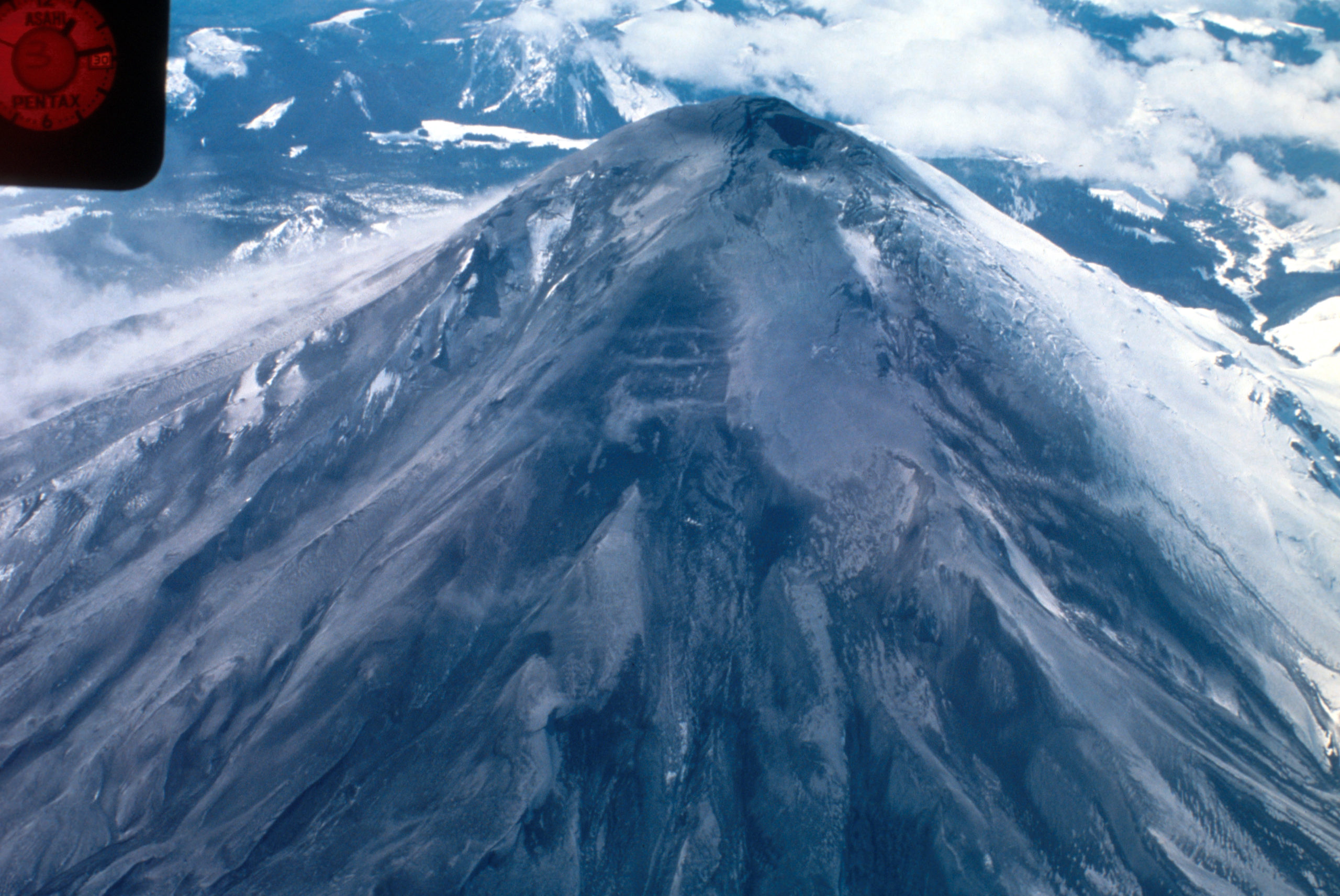
There’s this old saying about March: “In like a lamb, out like a lion.” This turned out to be very true in Loowit’s case as the 1980s began.
After over a century of peaceful slumber, Loowit (Mount St. Helens) began to wake. Seismic activity is nothing new around volcanoes, but this swarm was intense enough to shake the snow from her summit.

North side of Mount St. Helens, Washington, as of 24 March 1980. Numerous snow avalanche fracture scarps may be related to continued earthquake shaking. No signs of volcanic activity are evident. Caption and image credit: USGS
She still looked lovely and serene, but as March waned, signs became increasingly clear that magma was on the move in a serious way. (more…)
The Blanco Fault Zone Rides Again
Do we have to do this again so soon? Really? Oh, geez.

Must we really, CNN? Credit: Dana Hunter
I’m not going to link that article, because while it does quote seismologist Harold Tobin up front basically saying nothing to see here, folks, everything’s normal on the Blanco Fault Zone, it also tries to scaremonger. And I’m so over the scaremongering.
Listen. This is the Blanco Fault Zone. Earthquake swarms with many temblors of this magnitude are its specialty. It means absolutely nothing for the mainland. Zip. Zilch. Nada. Read this very good article on Oregon Public Broadcasting, which laid out the facts in beautiful form.
And no, this has utterly nothing to do with submarine volcanoes. No, not even Axial seamount. Dr. Jackie Caplan-Auerbach wrote an entire post explaining how much it’s not that:
There have been a lot of questions about the recent Blanco tranform activity, including whether these are related to volcanic activity in general, and Axial Seamount in specific. The short answer is no, these are definitively not volcanic quakes, but more detail follows.
First, the Blanco Transform fault is the most active fault in the Pacific NW, with very frequent quakes >M5. We can tell that these are normal Blanco faults by their location, by the way they fail (these are strike-slip earthquakes, consistent with the fault’s normal behavior, and happily, the type least likely to generate tsunamis).There is no volcanism associated with transform faults. The nearest frequently active volcano (and the one people most often ask about) is Axial seamount, which is ~300 km from the activity we are seeing on the Blanco this week. This is much too far apart for these features to be associated with one another.
And I swear we all have to do this every dang time.
For anyone who’s been worried that this is the harbinger of something geologically awful in the Pacific Northwest, please be assured that it is not. This is absolutely business as usual on the Blanco Fault Zone. This is what it does. It’s not going to trigger the Cascadia megatsunami. It’s not even going to cause any minor inconveniences to the mainland. Volcanoes aren’t going to be triggered. Literally the only way it’s going to become an issue is if we decide to build a seafloor city right on top of it. Which, knowing humans, someday we will definitely do.
Just a hair over two years ago, my Scientific American article explained why the Blanco should be considered a fun rather than fearsome fault zone. I shall now reproduce that article here, because literally nothing has changed except the date. Please bookmark this to reference whenever someone starts freaking out over the Blanco’s latest antics. It’s all chill, folks. Just enjoy it’s little productions! Because they’re actually entertaining and informative from an earth science perspective, just the way we like our geology. (more…)
Ghostly Geology
Halloween is here! This is my favorite part of fall: costumes, spooky stuff, decorating in black not only allowed but encouraged…. This is the holiday I was born for.
And I have some geology made for the holiday! This year, the theme is ghosts, and we’re going to visit some very ghostly geology and paleontology indeed.
1. Ghost Shrimp Haunts Ichnologist

This is a different kind of ghost shrimp than the ones under discussion, but it is metal enough for Halloween, so we’re rolling with it. Credit:
Freddie Alequin (CC BY-SA 2.0)
Paleontology isn’t just about bones and preserved bodies: a branch of it, ichnology*, also looks at the things those bodies left behind, like fossilized trails, tracks, nests, burrows, borings, excavations, and even the divots left by pee. In this post, my favorite ichnologist, Tony Martin, talks about a very unusual trace he found that would be even more exciting to find in the fossil record.
Life Traces of the Georgia Coast: Ghost Shrimp Whisperer
Geologists love ghost shrimp, too, because of how their burrows are so numerous, fossilize easily, and are sensitive shoreline indicators. I wrote about this before with regard to how geologists in the 1960s were able to map ancient barrier islands of the Georgia coastal plain by looking for trace fossils of these burrows. Since then, geologists and paleontologists have identified and applied these sorts of trace fossils worldwide, and in rocks from the Permian Period to the Pleistocene Epoch.
I could prattle on about ghost shrimp and their ichnological incredibleness for the rest of the year, but will spare you of that, gentle reader, and instead will get to the point of this post. Just when I thought I’d learned nearly everything I needed to know about ghost-shrimp ichnology, one shrimp decided I needed to have my eyes opened to some traces I had never seen them make before just a few months ago.
*Not to be confused with ichthyology, which has to do with fishies. It’ll help to remember that ikhnos means “track” or “trace” in Greek, while ikhthus means “fish.”
2. Ghosts of Minerals Past (more…)
“The Earthquake Was So Strong, And It Was Very Long:” The 2020 Aegean Sea Earthquake
The geologic story of the Mediterranean is seismic. Tectonic or volcanic, earthquakes abound. A look at any seismic monitoring page for the region will show a cacophany of tremors, most never felt. But every few years, sometimes more than once a year, stressed faults fail catastrophically, and the human toll is grim.
On October 30th, 2020, the 40 kilometer Samos Fault, just offshore from the Greek island of Samos, slipped at a depth of about 21 kilometers, unleashing a devastating earthquake that has been variously measured at M6.7, M6.9, and M7.0. The intensity reached VIII on the Mercalli scale. This was the largest magnitude the fault is capable of, and many witnesses said it’s one of the longest earthquakes they’ve experienced. One said the shaking lasted 25 seconds. That becomes an eternity when you’re trying to find safety. (more…)
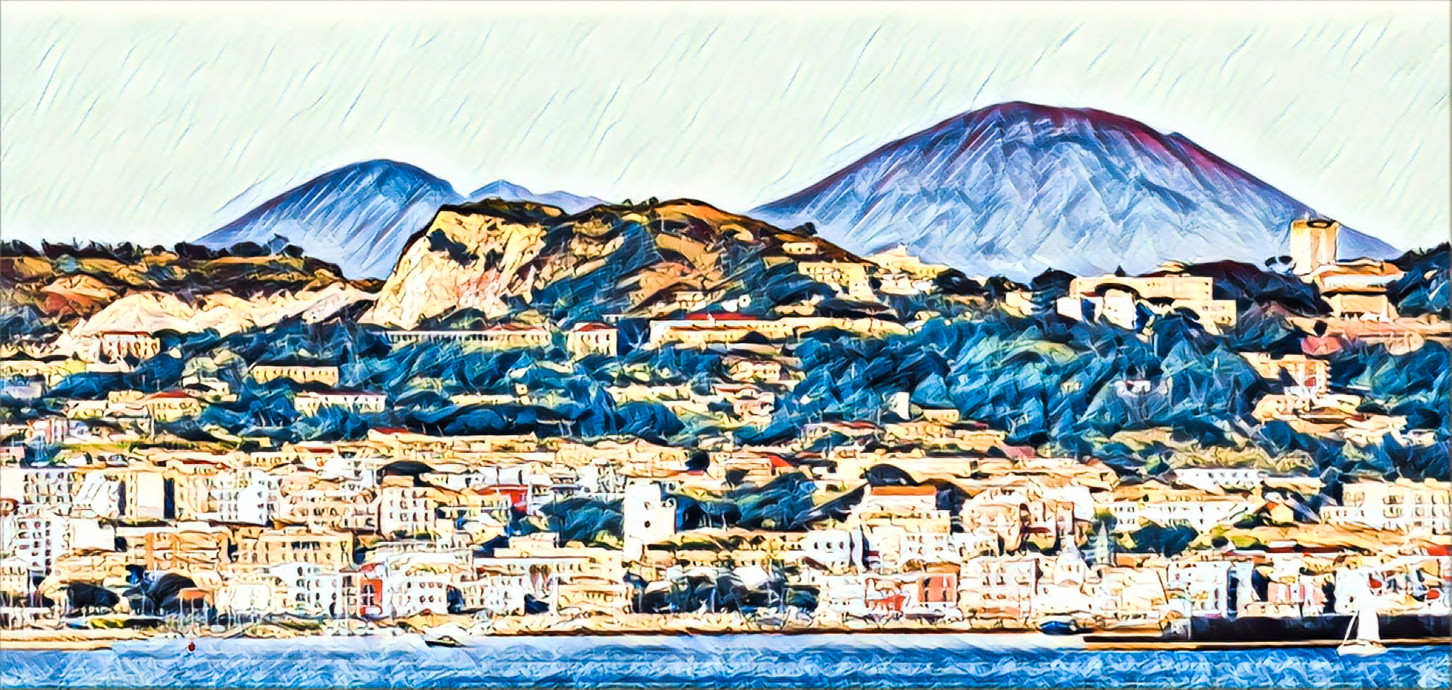
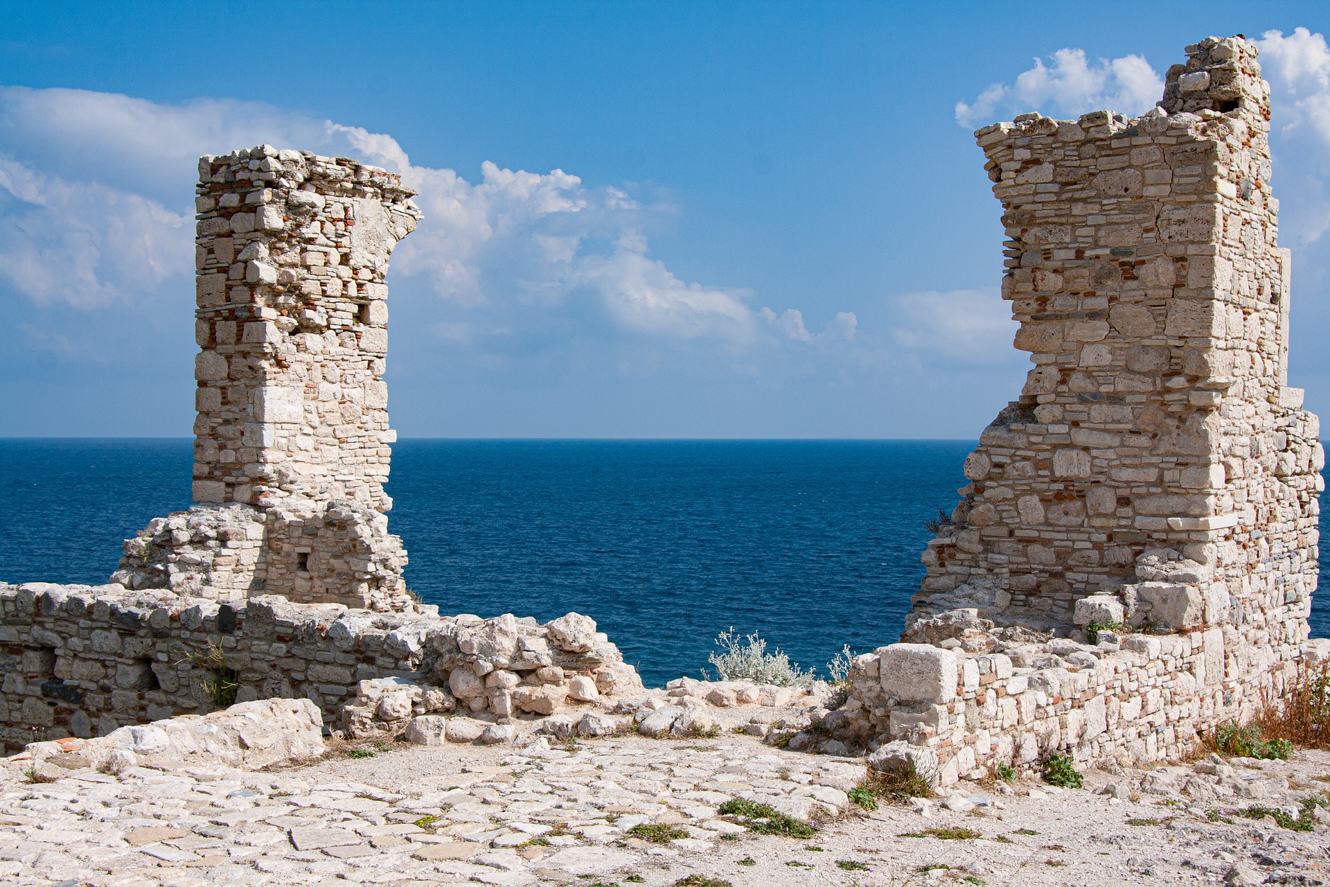
Sudden Volcanoes, Unstable Ground, and Sublime Rocks: Welcome to the Mediterranean
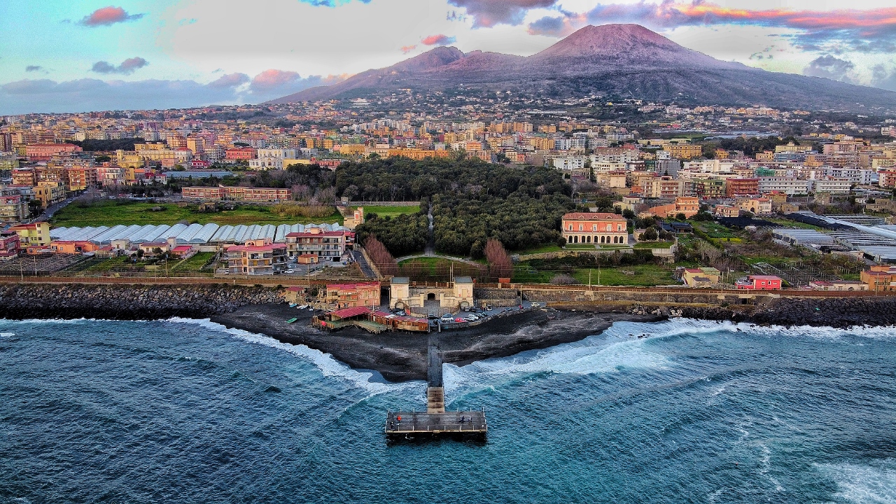
On this day in 1538, a brand-new volcano popped up on the coast of Campania, swallowed the village of Tripergole whole, and pretty much ruined the region’s medical spa industry. And that’s just one of the many astounding things geology has done in the Mediterranean region.
Earthquakes in the Time of COVID-19
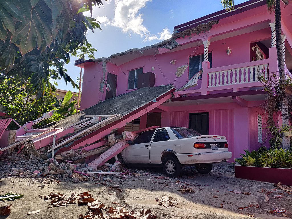
Puerto Ricans are facing a multitude of tough challenges right now. 2020 has been far from kind to the island and its residents, throwing challenge after disaster after threat at them.
Puerto Rico’s earthquake sequence rumbles on. For a few weeks, it seemed things were quieting down. I’d begun to wonder if it was finally petering out, but then came July 3rd, and two substantial earthquakes that let us know that the southwestern region of the island isn’t going to see an end to the shaking any time soon. And that’s just the start of the troubles plaguing the island.
Many of us are struggling in the face of this pandemic (especially those of us living in countries whose leadership didn’t take effective measures to contain the novel coronavirus, and are now facing ever-increasing rates of infection and death). But being hit with a murderous virus while the earth is nearly constantly shaking, and you’ve lost your home just when you most need to shelter in place, is extra horrible.
Oxaca Earthquake: Another Shaky Tuesday on the Middle America Trench
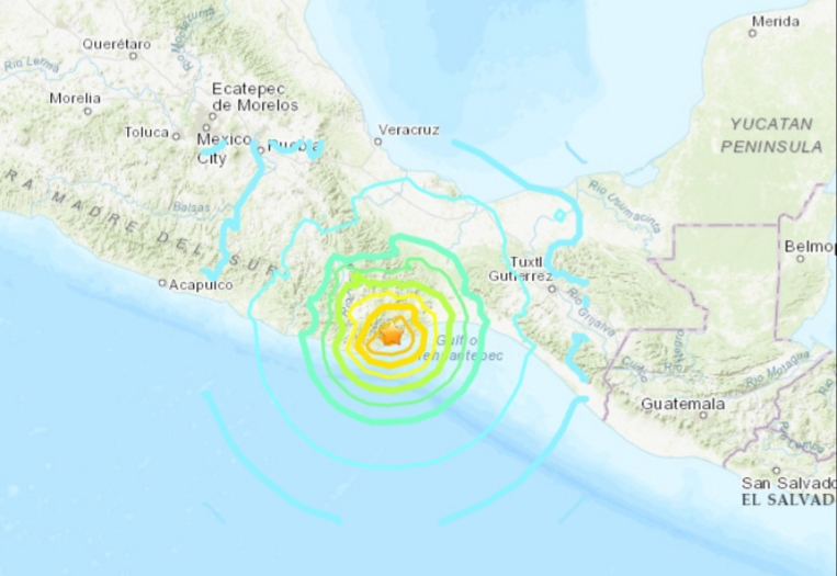
I know, it seems like we were just talking about this, at least geologically speaking. (more…)