Tag: natural disaster
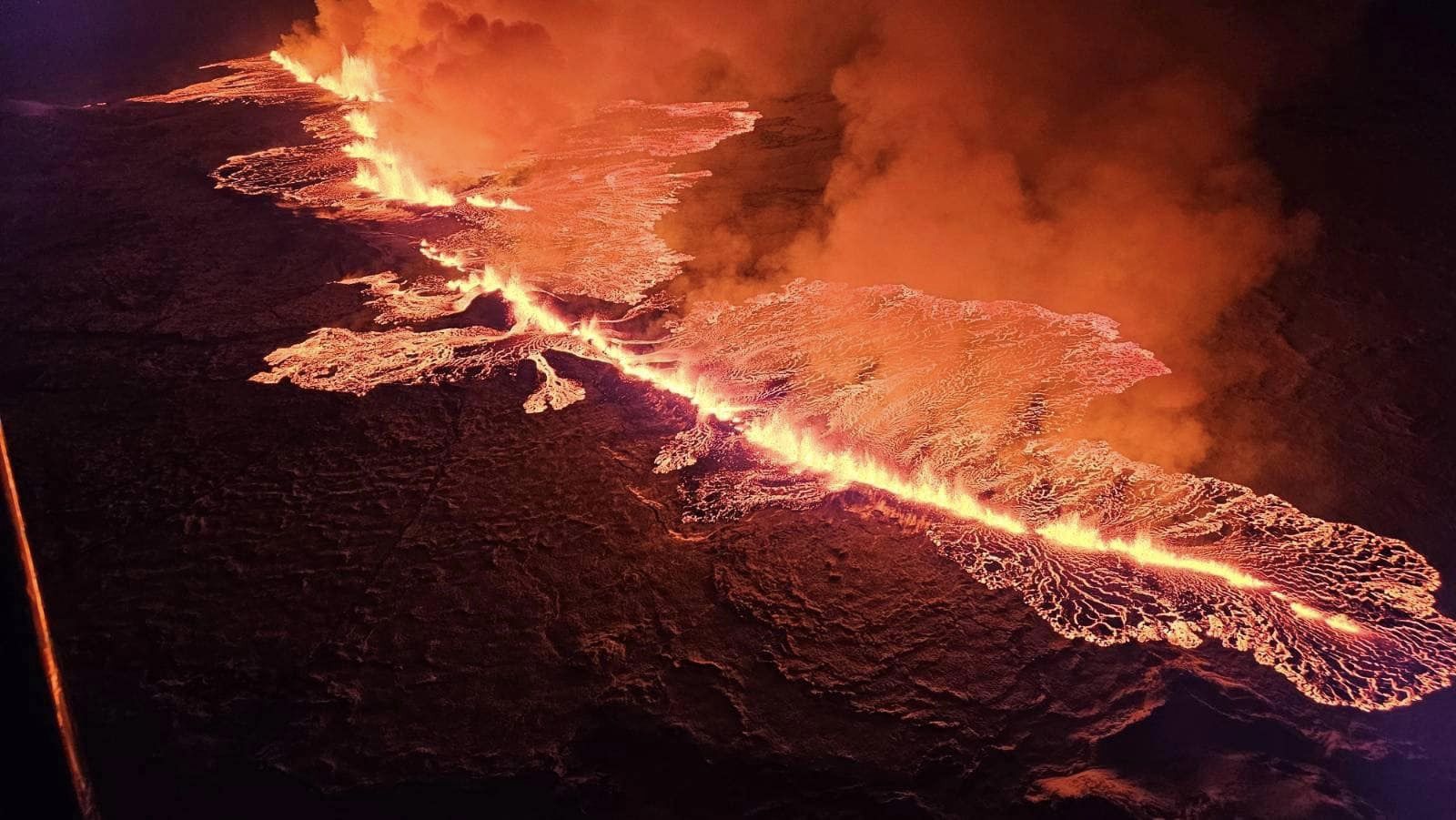
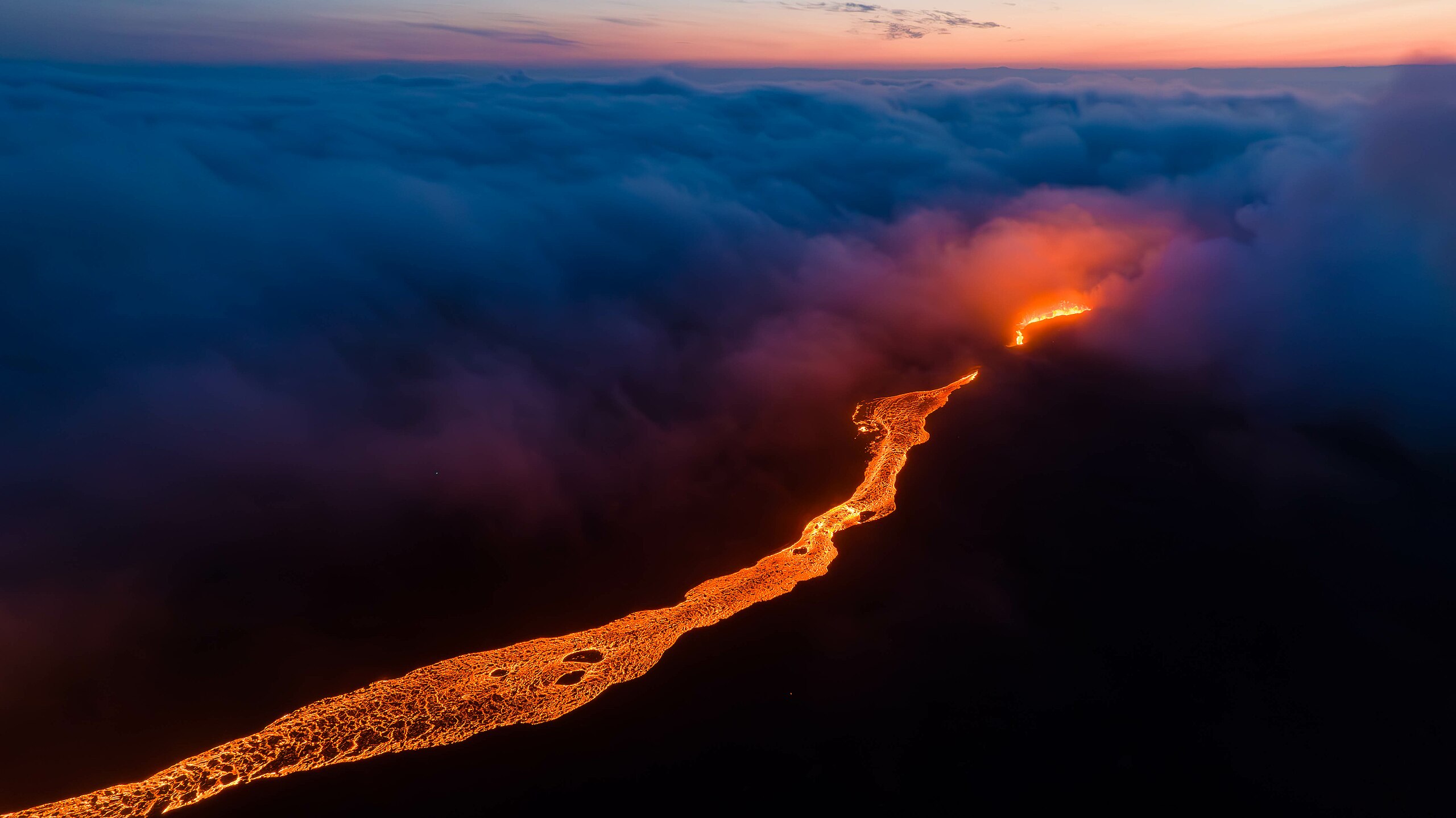
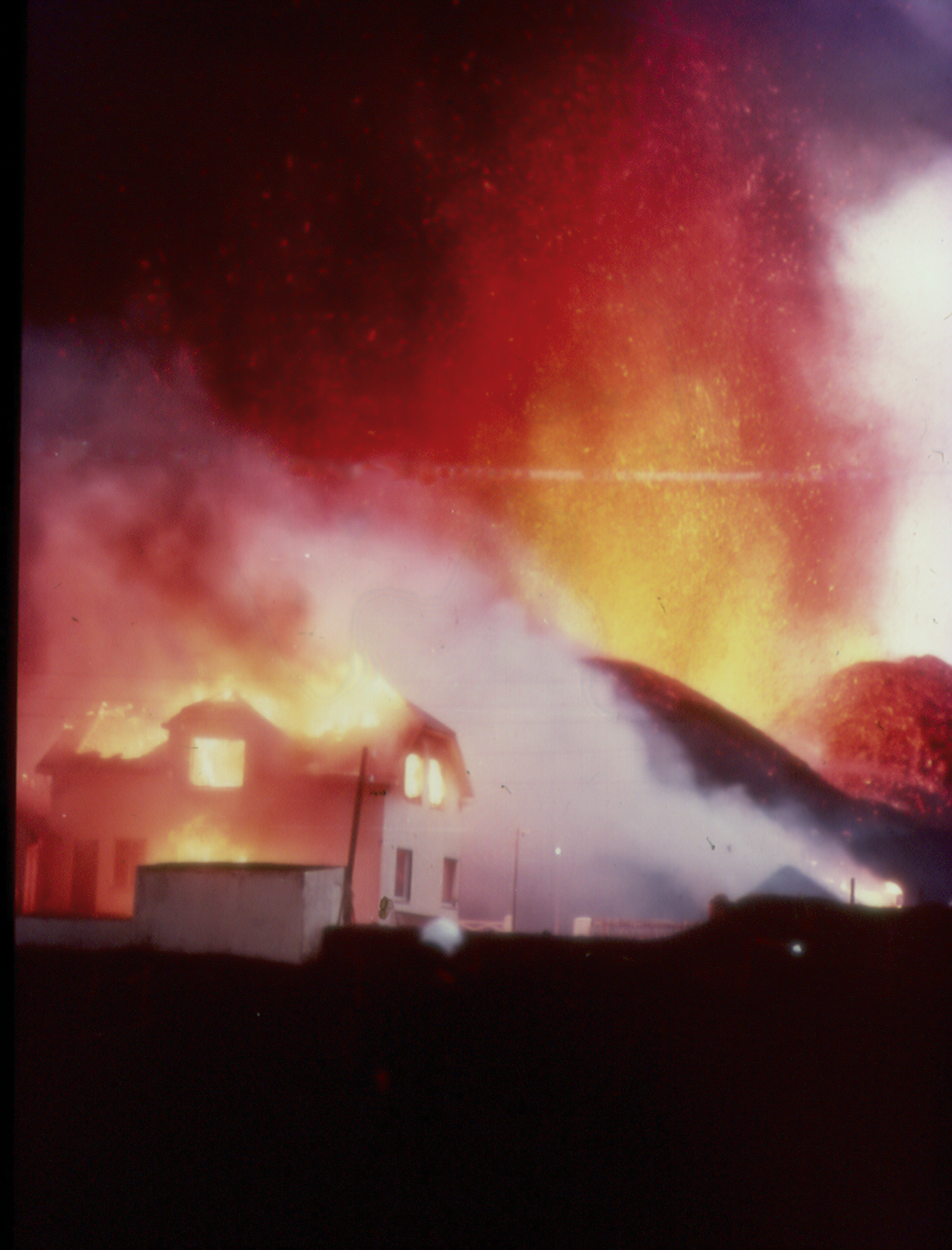
Alas, Poor Grindavík Volume 2: Lava Invades the Town
It was inevitable, really. Iceland got lucky for the first four eruptions on the Reykjanes Peninsula, but when volcanoes are rolling dice in populated areas, they eventually get snake eyes and buildings burn. Grindavík had a Christmas reprieve, but the new year isn’t starting off so well.
That’s life on a reawakened volcanic peninsula.
From virtually the moment the 2023 Sundhnúkur eruption ended, we knew the volcano wasn’t done. The ground began rising, signalling intruding magma. I was surprised when Icelandic authorities allowed townspeople to return to Grindavík and the Blue Lagoon reopened for tourists. The Eldvörp–Svartsengi volcanic system was letting everyone know, very clearly, that it wasn’t done with the lava and that it wouldn’t be done for some time. It was just taking a holiday break. But Icelandic folks are made of tough stuff, and the small matter of a restless volcano wasn’t going to keep them from living life as normally as possible. They just kept a wary eye on the thing and carried on.
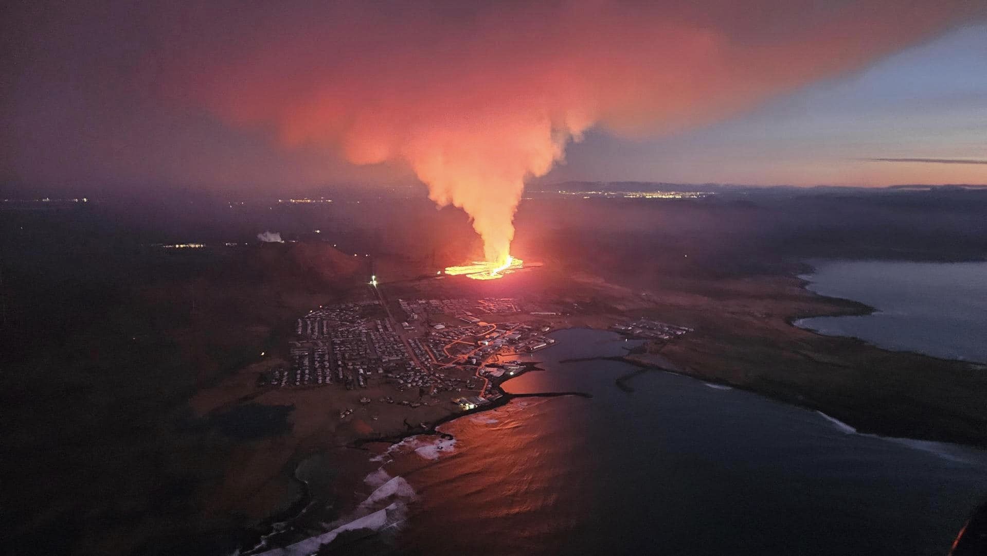
Things were coming to a head going into the weekend, and authorities had issued an evacuation order for Grindavík come Monday. The volcano couldn’t wait that long. Around 3 am Iceland time, a dramatic increase in seismic activity let everyone know go time was now. Sirens sounds, emergency alerts texted, and people fled just in time. (more…)
Alas, Poor Grindavík: Iceland Eruption Commences in a Terrible Location
The Reykajanes volcanic system just gave Iceland an awful early Christmas present: a brand new eruption in nearly the worst possible spot. Alas, we can’t return it.

Aerial view of the eruption taken from a Civil Defense helicopter a few hours after the eruption started. Credit: Almannavarnadeild ríkislögreglustjóra
Iceland Eruption Nearly Inevitable; Grindavík Could Go Under Lava
Up til now, volcanic eruptions on Iceland’s Reykjanes Peninsula were benevolent tourist attractions. They put on pretty shows and confined themselves to remote, unpopulated areas, clustered around Fagradalsfjall. No important infrastructure was harmed. People got to hike up and safely experience the birth of a new volcano. It was as good as volcanic eruptions get.

Previous Fagradalsfall Eruption Sites. Credit: Icelandic Meteorological Office
Magma started intruding under Fagradalsfjall in September, just a couple of months after the end of its third eruption. Until late October, it didn’t look like things would get too exciting. But a seismic swarm started near the Blue Lagoon area just north of Grindavík late on the 24th and ramped up dramatically overnight. Over one thousand earthquakes, the largest a M4.5, were recorded overnight, most at a depth of around 5 kilometers. By the next day, the numbers had risen to 4,000, some as shallow as 2 kilometers. And the ground was beginning to deform.
On the 27th, horizontal ground displacement was already up to 2 centimeters, and a M4.0 was recorded just 2 kilometers north of Grindavík. Yikes.
But magma hadn’t started moving on up yet.
The 2023 Turkey Earthquakes: “It Felt Like It Would Never Be Over”
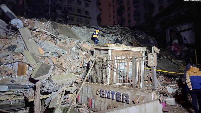
Turkey and Syria are reeling after being struck by two enormous earthquakes in quick succession. Both earthquakes occurred along the East Anatolian Fault Zone; between them and their aftershocks, the damage is catastrophic, and the death toll is already in the thousands and rapidly climbing.
The first earthquake, striking near Gaziantep at 4:17 am local time, was measured by the USGS as a M7.8. At first, it wasn’t clear whether this earthquake struck within the East Anatolian Fault Zone (EAFZ) or the Dead Sea Transform fault zone. As of this writing, it appears it was located within the EAFZ.
The second earthquake struck near Ekinözü at 1:24 pm local time, and measured as a M7.5. Though it was 95 kilometers northeast of the initial quake and on a separate fault, it qualifies as an aftershock instead of a stand-alone earthquake. More on that later in this post.
We won’t have a clear picture of precisely which faults were involved, the details of the earthquakes, and the implications for the region going forward for months, possibly longer. Once we have some solid science, I’ll write up a properly detailed post for you. For today, I’ll go over some of the best available science, share some sobering videos, and provide ways you can help people in the affected region. (more…)
Eldfell Eruption: 50 Years Ago, a Village Fought the Lava and Won
Imagine going to sleep one night, and then being awakened in the small hours of the morning by a volcano that’s suddenly erupting right beside your town. Fifty years ago, this was the scene for residents of the small Icelandic fishing town of Heimaey, on the island of the same name.
One day, I will write it up properly. It’s an eruption that has fascinated me since childhood, and it’s a wonderful example of people battling lava and pretty much winning. But today is not that day. Instead, I have a collage of videos for you, including one featuring a younger David Attenborough on location. How awesome is this? (more…)
42 for Loowit’s 42nd vol. 7: Reprise
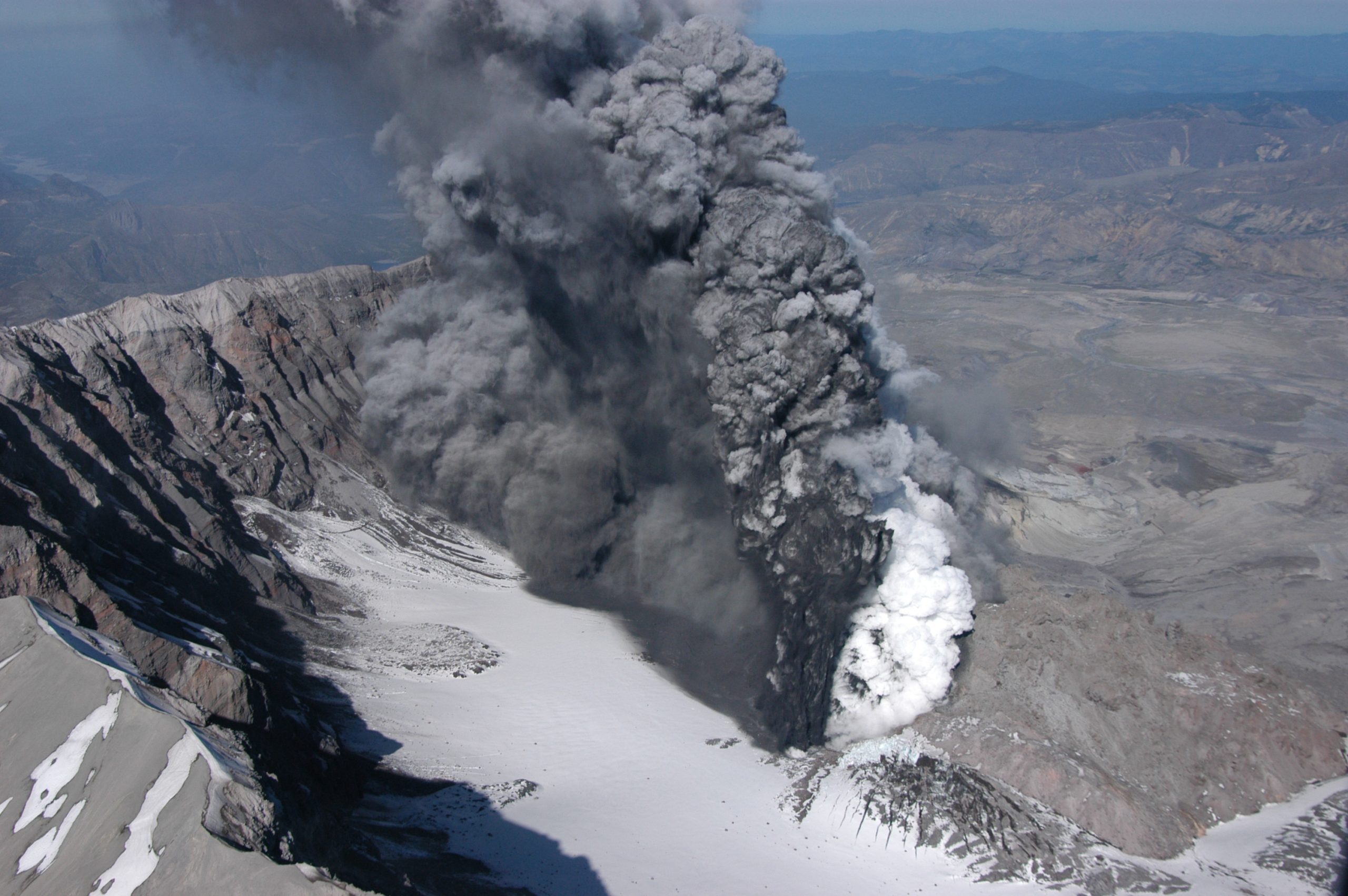
There was life in the old girl yet.
To be fair, though, Loowit (Mount St. Helens) isn’t very old as far as volcanoes go. So when she rumbled awake in late September of 2004, volcanologists weren’t terribly surprised. She’d slumbered for less than 20 years after her 80s eruptive sequence, but it wasn’t shocking to see magma on the move again.
Her prompt eruption on October 1st signalled a new phase of dome building. And this time, we had better cameras, better monitoring equipment, and the plans in place to do some serious monitoring.

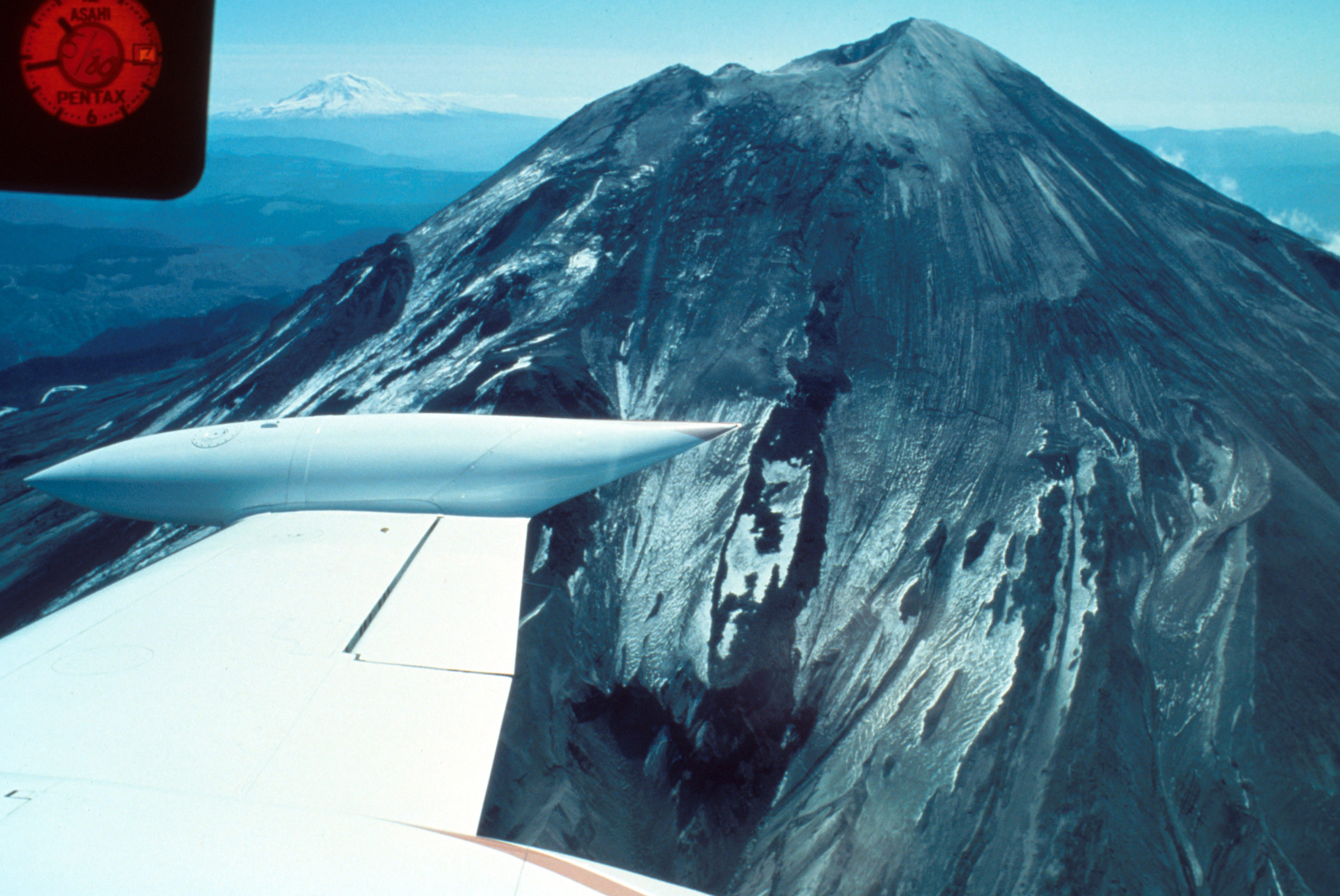
Dome within Mount St. Helens’ crater is hot and glowing as it grows, viewed from Johnston Ridge Observatory (JRO), with base of small steam and ash plume. 11/4/2004. Caption and image credit: USGS
She put on a beautiful show. (more…)
42 for Loowit’s 42nd vol. 6: Beauty in Destruction
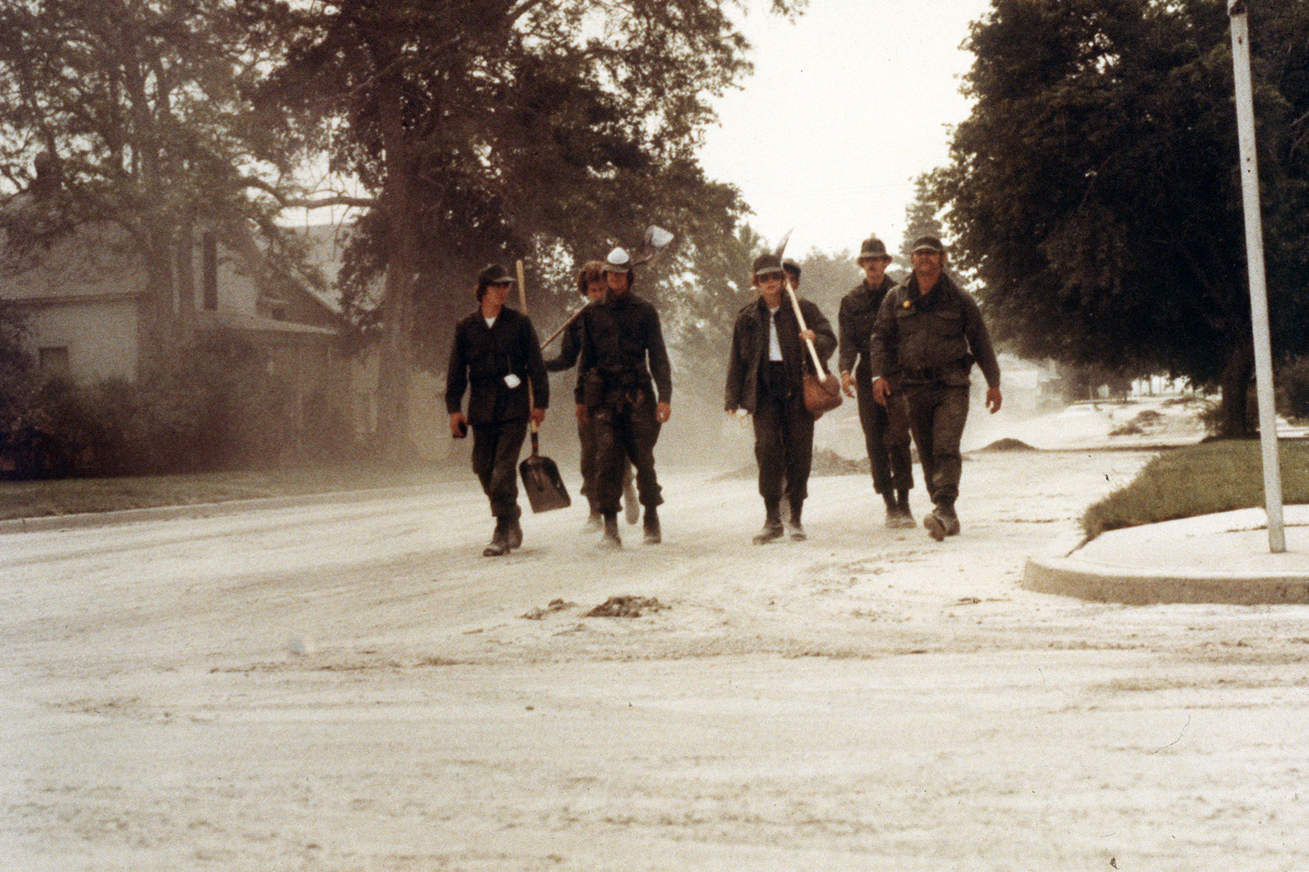
Volcanoes leave one heck of a mess to clean up when they explode near civilization. It’s not pretty, although as you can see above, it sometimes looks pretty metal.
While Washington State called out the National Guard and folks figured out how to cope with the copious ash, volcanologists picked through the ruins of a once-verdant forest, measuring various volcanic deposits and learning all they could from them. At first, it was shocking. But once you started adjusting to the change, you could start seeing the beauty in the devastation.
Look at the channel carved through the debris avalanche here: you can see gorgeous reds in the gray where hydrothermally altered rock from the former summit mixed with the more prosaic grays of younger material. The iron-stained creek flowing through added more color to the moonscape. It was alien and strangely pretty. (more…)
42 for Loowit’s 42nd vol. 5: Cataclysm
It’s a beautiful, quiet morning with spectacular weather, and then suddenly it isn’t. An earthquake strikes, the bulge gives way, and the volcano blows up and out.

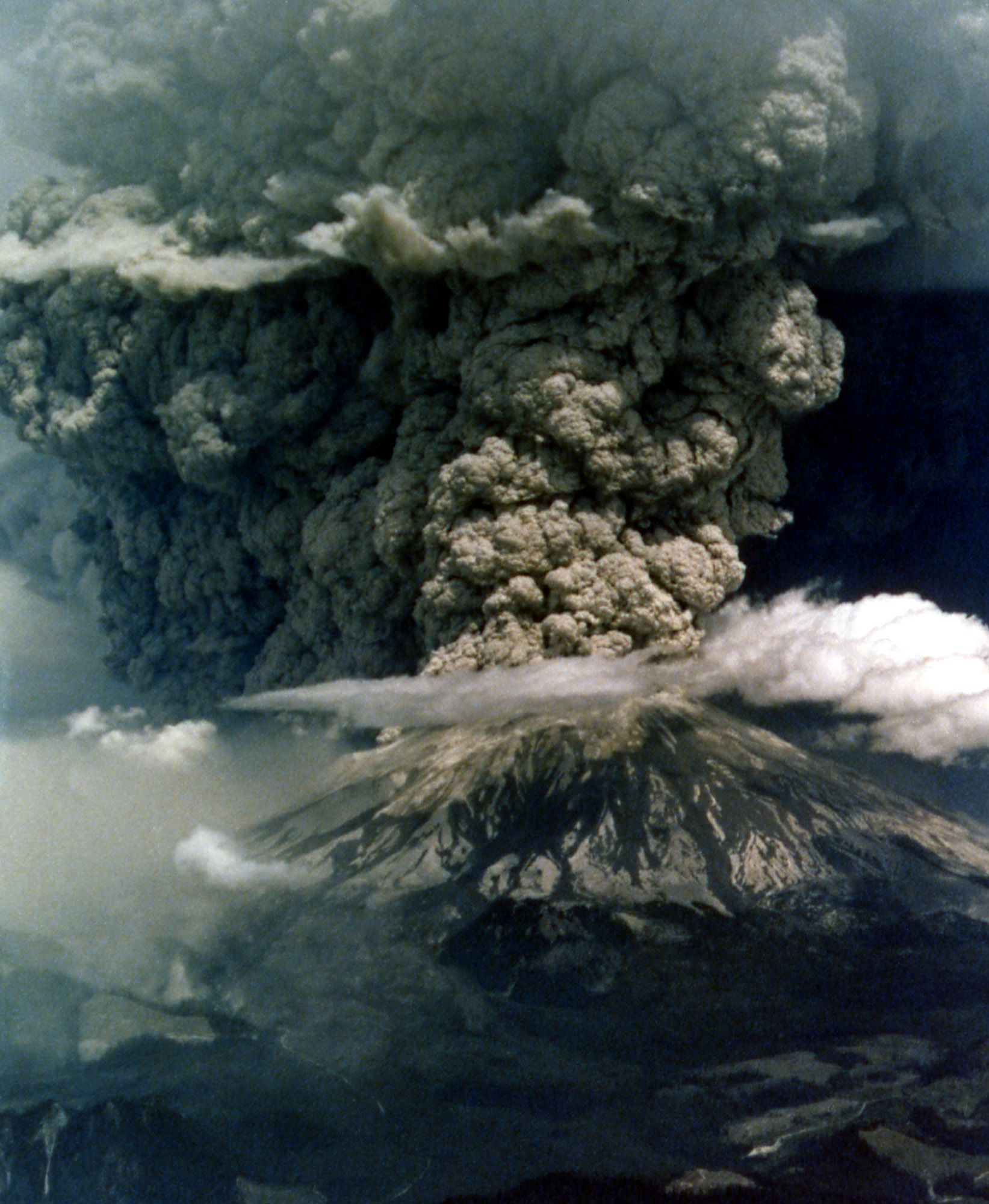
Mount St. Helens in eruption. Aerial view of base of eruptive column, crater rim at right. Shows “cauliflower” effect in column. 1235 hrs PDT. Skamania County, Washington. May 18, 1980. Caption and image credit: USGS
This actually isn’t a particularly large eruption. Between the lateral blast, Plinian ash column, and the pyroclastic flows, it totals only about 1.4 cubic kilometers of material. Barely a VEI of 5. But if you’re in it, it seems large enough to have swallowed the world. It is, indeed, cataclysmic.
42 for Loowit’s 42nd vol. 4: Menacing May
May had begun with an ominous quiet.
Ominous? Surely a restless volcano quieting down is a good thing!
Yeah, not when you’ve got one flank of the mountain growing a bulge like a demonic pregnancy and displaying worrying new thermal anomalies. Add in earthquakes and dramatic swelling, and you’re sure the volcano is ready to pop.

Geodimeter station at Toutle Canyon near Mount St. Helens. Skamania County, Washington. May 2, 1980. Caption and image credit: USGS
[Monty Python voice] Look at the bulge! (more…)